The following is an extract from a report for my degree dissertation, on the history of Shoreham Port:-
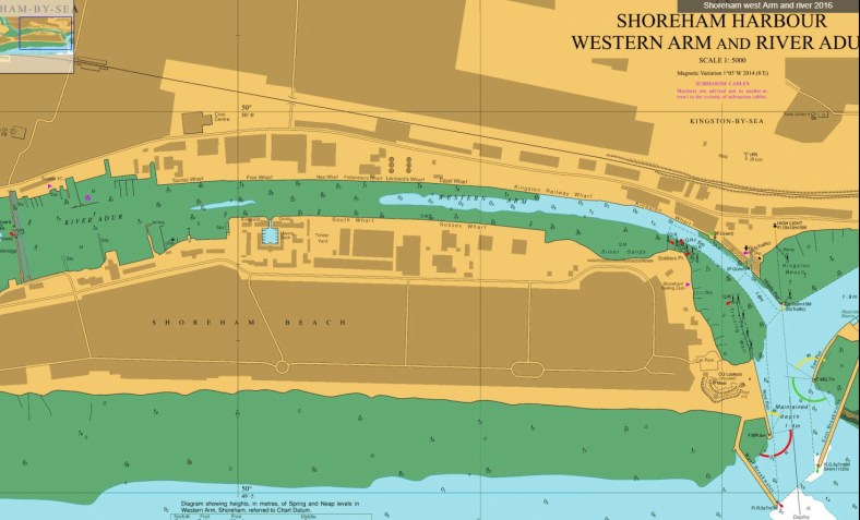
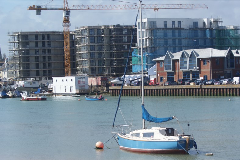
Image 1. Western arm of Shoreham port, which encompasses the lower reaches of the River Adur.
Shoreham port sits at the mouth of the river Adur in West Sussex. It is a location that has had a working port sited in the area for many hundreds of years (Baggs et al, 1980). Because of the requirement to maintain a working depth of water for vessels to access the port (Image 3), historical attempts to manage the river channel have produced the present format of the port and coastline (Image 2) (Pritchard, 1843: Kleinhans et al, 2010). Consistent and extensive building of a shingle bar from the effects of longshore drift (Bird, 2008) produced what is now Shoreham Beach, and the present location of the river mouth.
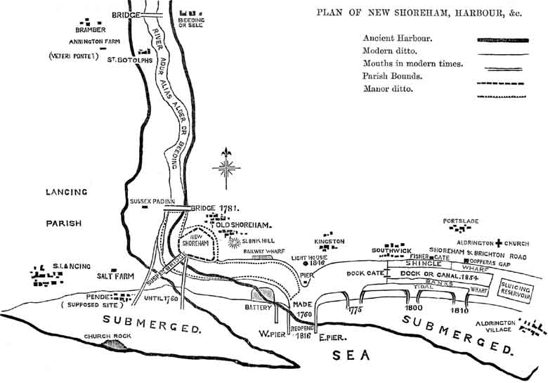
Image 2. Map of New Shoreham, circa 1833. Source http://shoreham.adur.org.uk
The continued marine sediment input (Bird, 2008), and movement of the coastline (Dike and Agunwamba,2012) is the first aspect of the sediment budget for the area investigated. Tidal flow continues to provide a sediment input to the area being examined (Pacheco et al, 2007), and beyond as far North as Steyning and Upper Beeding, well beyond the area being surveyed (Environment Agency, 2009).

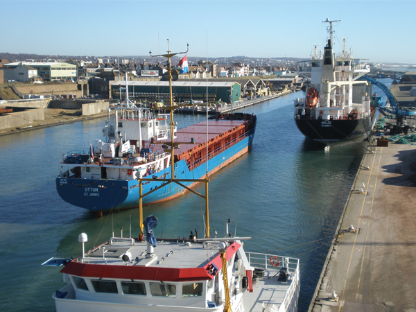
Image 3. Painting of the River Adur and Shoreham in the background. Circa 1879 by James R Knnear. Royal Pavilion & Museums, Brighton & Hove ©
Fluvial input of sediment is then added to the sediment budget for the lower reaches of the River Adur (Owens et al, 2005: Kirby, 2013). The exact volume, type and particle size of the sediment within the water column will hopefully enable us to quantify the sources of the sediment currently within the water column.
Whilst large areas of the River Adur’s lower reaches encompass mud flats, and these have been examined extensively, we will not be specifically looking at aspects of these (Law et al, 2002; Mudd et al, 2010). Precipitation levels will have an impact on the fresh water volumes passing through the survey area, and will therefore be monitored in the days leading up to surveys, and duly recorded from the nearby meteorological office at Shoreham Airport, or through Environment Agency monitoring stations along the river.

Image 4. Current River mouth and port entrance. Image source S.Hall
Current research at a number of European ports are looking at methods of managing the sediment flow within the water column (Cappucci et al, 2011), and the concept of “Keep Sediment In the System” (KSIS) as developed by Kirby (2013), either by current deflecting walls (CDW) or in-situ conditioning and the use of ‘fluid muds’ (Kirby 2011). These methods are in stark contrast to the more traditional methods of hard engineering (Image 4), dredging and silt pumping (Manning et al 2011).
The scope of the project is to merely assess and try to quantify the sediment transported within the water column. The implications for future development of both the Port Authority’s sediment management regime, and the current or future attempts to manage the sediment within the surveyed area will hopefully be something that can be developed from our findings (Bates et al, 2015).
References
Baggs, A.P., Currie, C.R.J., Elrington, C.R., Keeling, S.M. and Rowland, A.M. “Old and New Shoreham,” in A History of the County of Sussex: Volume 6 Part 1, Bramber Rape (Southern Part), ed. T P Hudson (London: Victoria County History, 1980), 138-149.
Bates, M.E., Fox-Lent, C., Seymour, L., Wender, B.A. and Linkov, I., 2015. Life cycle assessment for dredged sediment placement strategies. Science of the Total Environment, 511, pp.309-318.
Bird E.C.F. 2008. Coastal geomorphology. Wiley. 2nd Edition
Cappucci, S., Scarcella, D., Rossi, L. and Taramelli, A., 2011. Integrated coastal zone management at Marina di Carrara Harbor: sediment management and policy making. Ocean & coastal management, 54(4), pp.277-289.
Kirby, R., 2013. Managing industrialised coastal fine sediment systems. Ocean & coastal management, 79, pp.2-9.
Dike, C.C. & Agunwamba, J.C. 2012, “STUDY ON THE EFFECTS OF TIDE ON SEDIMENTATION IN ESTUARIES OF THE NIGER DELTA, NIGERIA”, Journal of Urban and Environmental Engineering, vol. 6, no. 2, pp. 86-93.
Environment Agency, 2009. Adur Catchment Flood Plan. Available from https://www.gov.uk/government/uploads/system/uploads/attachment_data/file/293867/Adur_Catchment_Flood_Management_Plan.pdf (Accessed 29 March 2018)
Kleinhans, M.G., Weerts, H.J.T. & Cohen, K.M. 2010, “Avulsion in action: Reconstruction and modelling sedimentation pace and upstream flood water levels following a Medieval tidal-river diversion catastrophe (Biesbosch, The Netherlands, 1421–1750 AD)”, Geomorphology, vol. 118, no. 1, pp. 65-79.
Law, R.J., Kelly, C.A., Baker, K.L., Langford, K.H. & Bartlett, T. 2002, “Polycyclic aromatic hydrocarbons in sediments, mussels and crustacea around a former gasworks site in Shoreham-by-Sea, UK”, Marine Pollution Bulletin, vol. 44, no. 9, pp. 903-911.
Manning, A.J., Van Kessel, T., Melotte, J., Sas, M., Winterwerp, H. & Pidduck, E.L. 2011, “On the consequence of a new tidal dock on the sedimentation regime in the Antwerpen area of the Lower Sea Scheldt”, Continental Shelf Research, vol. 31, no. 10, pp. S150-S164.
Owens, P.N., Batalla, R.J., Collins, A.J., Gomez, B., Hicks, D.M., Horowitz, A.J., Kondolf, G.M., Marden, M., Page, M.J., Peacock, D.H. and Petticrew, E.L., 2005. Fine‐grained sediment in river systems: environmental significance and management issues. River research and applications, 21(7), pp.693-717.
Pacheco, A., Carrasco, A.R., Vila-Concejo, A., Ferreira, Ó. and Dias, J.A., 2007. A coastal management program for channels located in backbarrier systems. Ocean & Coastal Management, 50(1-2), pp.119-143.
Pritchard, W.B., 1843. The report of W. B. Pritchard, esq., C. E., to the commissioners of shoreham harbour, on the cause of the existence of the shingle bar at the mouth of shoreham harbour, and the proposed mode of keeping the mouth of the said harbour permanently free. (1843). Architect, Engineer and Surveyor, 4(42), 206-211. Retrieved from https://search-proquest-com.ezproxy.brighton.ac.uk/docview/6705695?accountid=9727